... with a strong emphasis on the Langdale Pikes & Bowfell, my favourite Lakeland mountains ...
I have been looking back at a decade of photos from various Lake District walks and pondering whether it is worth putting these old trip reports up on the blog. I very quickly decided not to as most are day walks which countless others have done countless times. But there are a few reasonable pictures amongst the many mediocre ones and it seems a shame to have them sat on my hard drive gathering the proverbial dust. So I thought I would post a collection of my favourite photos from many different walks, a gallery of my best photography efforts I suppose.
To put things into context I must state for the record that I am very much a point & shoot photographer and only carry a compact camera. I have a working knowledge of the basic theory of photography but a woefully limited ability to put that knowledge into practice. If I'm being honest with myself, I think it boils down to a lack of patience. For this reason I will never have the skills or artistic flair for 'proper' landscape photography. For an
appreciation of just what can be achieved with such skills I refer you
to jameslomax.com , stewartsmithphotography.co.uk, wastwaterphotography.co.uk and alexatkinsonphotography.co.uk
My own efforts are very much secondary to the walk and serve to provoke
memories and capture the views which I find inspiring. I tend not to
let the camera guide the walk too much although admittedly, with increasing regularity, I'm finding myself loitering on fell tops waiting for the light to get just that little bit
better. I'm not kidding myself though. The good ones have largely been a series of lucky flukes or through just being in the right place at the right time. Wild camping in
the Lake District has certainly helped with the latter as the first and
last hours of the day really bring out the best of the fells and it is
hard not to capture at least some of this splendour with a half decent
camera and a vague idea of where to point it. And so here are a
selection of my favourite flukes of my favourite fells.
First up are the Langdale Pikes. As with most folk who spend time in the Lakes, I never tire of looking at their iconic profile. Wherever I am in the lakes, from whatever fell top, I always tend to survey the skyline looking for the familiar shapes of the classic lakeland fells by which to work out my bearing. The Langdale Pikes, along with Great Gable, must be the most 'looked for' landmarks by which I can then place other surrounding fells. Some folk talk about mountains provoking certain feelings; the 'Pikes' feel homely to me, perhaps because they sit proudly in the middle of the area I am most familiar with in Lakeland.
In my opinion nobody sums up the Lakeland fells better than Wainwright himself. This is what he has to say on the 'pikes'. "No mountain profile in Lakeland arrests and excites the attention more than that of the Langdale Pikes and no mountain group better illustrates the dramatic appeal of a sudden rising of the vertical from the horizontal; the full height from valley to summit is revealed at a glance in one simple abrupt upsurge to all travellers on the distant shores of Windermere and, more intimately, on the beautiful approach along Great Langdale." Poetry indeed.
 |
| May 2011 - Langdale Pikes over Elterwater |
Of course the 'Pikes' are generally accepted as referring to four distinct peaks; Harrison Stickle, Pike of Stickle, Loft Crag and Pavey Ark. Only from the south can they all be seen together from a single vantage point and so the 'Langdake Pikes' may mean different things to different people depending on where they are viewed. The picture above, taken from Elterwater, shows the typical 'tourist' profile of Harrison Stickle in the centre with Loft Crag on the left and Pavey Ark on the right. This is the aspect also seen from Bowness and the road to Ambleside and therefore adorns the many place mats and coasters in their trinket shops. But for a finer appreciation of the Pikes you have get in, amongst and around them.
 |
| October 2010 - The Langdale Pikes southern profile |
This aspect shows the Pikes seen over Wrynose Fell from 'Prison Band' and was taken while walking from Swirl How to Wetherlam. The distinct profile of Pike of Stickle can now be seen on the far left, while Loft Crag loses its profile against High Raise. Harrison Stickle is the highest point on the right and Pavey Ark is just visible through the cloud.
 |
| October 2010 - Pike of Stickle and a local |
The picture above was taken from the 'Band' at the start of a long walk from the Langdale valley to Scafell Pike and back. This was one of my most enjoyable days in the fells. The route is described here
 |
| October 2010 - Mickleden and the Great Langdale Valley |
This picture was taken from Rossett Gill and shows Pike of Stickle bathed in dappled evening sun on the return journey from the Scafell Pike walk. Mickleden Beck winds its way along the Great Langdale Valley towards Lingmoor Fell. From a technical perspective its a poor shot, the highlights are badly blown but I don't care. I like the colours of the scorched Bracken and the contours of the valley.
 |
| October 2010 - Pike of Stickle & Loft Crag from Mickleden |
The above shows Pike of Stickle from valley floor to summit. On my 'to do' list is a direct ascent of this face and along the gully on the right. It looks as if it couldn't take more than 1/2 hour but of course looks can be deceiving. The full height is 2323 feet and the vast majority of those feet are climbed in one direct line from valley floor to summit.
 |
| Jan 2013 - looking mean & moody in their winter coat, from Oxendale |
 |
| October 2010 - The Langdale Pikes over Rossett Pike from Great End Summit |
The summit of Great End must offer some of the best views in Lakeland. This picture looks down under darkening clouds along the Great Langdale valley with three of the Langdale Pikes on display and Windermere visible in the distance over Lingmoor Fell.
 |
| October 2010 - Langdale Pikes over Rossett Pike |
This must be my favourite view of the Pikes. I always think there is something special about looking down on these majestic fells from a high vantage point. Their profile is somewhat lost from the lofty heights of Bow Fell & Esk Pike but on the descent between Esk Hause and Rossett Pike they slowly begin to take shape again against the skyline to the point where you just have to stop and admire.
 |
| March 2010 - Loft Crag from Pike of Stickle summit |
 |
| March 2010 - Harrison Stickle, Pavey Ark & Stickle Tarn |
This shows the western side of the pikes where just Harrison Stickle & Pavey Ark can be seen. It was taken from near Blea Rigg on a cold March morning. Stickle tarn is still frozen.
 |
| April 2011 - Pavey Ark showing Jacks Rake |
This picture shows the best way up Pavey Ark. Jacks Rake is a steep scramble seen climbing diagonally under its shear face. Whilst it looks like a terrifying prospect from this vantage point, the route is fairly straight forward and with a much lower sense of exposure that seems likely when gazing up from below.
Next up is Bowfell, admittedly my favourite place to be in the lakes. If the Langdale Pikes feel 'homely', Bow Fell feels decidedly more harsh & intimidating. This may be because it seems to attract cloud and bad weather like no other fell and once visibility lost, its summit can feel hostile and disorientating. For me, the best ways up are via The Band or from Crinkle Crags, but with either way, the climbers traverse / great slab route show the superb rock scenery at its best. For lots more pictures and detailed route see here.
 |
| Oct 2010 - Bowfells rock scenary from the climbers traverse |
The above picture is taken from climbers traverse and shows Cambridge Crag on the left and Bowfell Buttress on the right. A brave walker could scramble up the gully between the two but the best way up from this point is to follow a steep diagonal path along the left side of Cambridge Crag which then emerges by Great Slab.
 |
| Oct 2010 - Great Slab on Bowfell |
This is the iconic viewpoint of Great Slab as drawn in Wainwright's pictorial guide. In the background, the Langdale Pikes complete the scene.
 |
| Oct 2010 - Great Slab & Bowfell Buttress |
This view shows the diagonal route along Cambridge Crag and Great Slab from the climbers traverse route. Two tiny figures can be seen emerging from the top of the boulders to give some scale to this grand scene. Walkers who choose the 'normal' way up Bowfell would miss out on this stunning rock scape.
 |
| Oct 2010 - Esk Pike, Bowfell and Crnkle Crags from above Esk Hause |
|
Bowfell's slightly more serene face is on the Eskdale side. This view is from the path from Great End to Esk Hause and shows Bowfell as the highest point and the Crinkle Crags trailing off on the right.
 |
| Oct 2012 - Great Slab as seen in profile from Rossett Pike |
Next up are a random selection of favourite pics from many different walks. As you may have gathered, I'm attracted to pointy bits of rock when out in the fells so most are of that ilk. There is less chit chat and more pics.
 |
| Feb 2011 - Sharp Edge On Blencathra. A tiny figure about to take the plunge |
 |
| Feb 2011 - Sharp Edge complete with brave walker |
 |
| Feb 2011 - Sharp Edge showing its 'sharpness' |
 |
| June 2011 - Sprinkling Tarn and Great Gable |
 |
| Scafell Pike, Lingmell & Scafell from Great Gable |
 |
| June 2011- Great Gable summit view over Sprinkling Tarn & Allen Crags towards Langdale Pikes and Windermere |
 |
| June 2011 - Looking over Haystacks to Buttermere from Green Gable |
 |
| Great Gable from Green Gable |
 |
| March 2012 - Sunrise over Crinkle Crags following a wild camp on Scafell summit |
 |
| Feb 2013 - Looking towards the Scafell's in the early morning from Grasmoor summit |
And to finish, some of my favourite winter photos. I, like many others, love the fells in winter. The presence of snow and ice not only present a new challenge to the walker but shows the fells in a completely different perspective. Familiar routes look alien when doused in the white stuff and fell tops look their majestic best when snow covered. Of course this also means heavy packs, warm & bulky clothes, short daylight hours and often the use of ice axe & crampons. All is worth it though .....
 |
| Crepuscular Rays illuminate the Fairfield Horseshoe |
 |
| ... and more such rays over Grasmere |
 |
| Yoke, Ill Bell & Froswick while on the Kentmere Horseshoe |
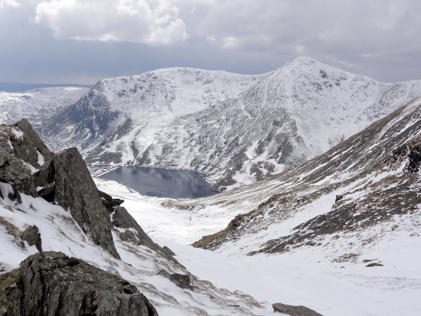 |
| Kentmere Reservoir from the flanks of Harter Fell |
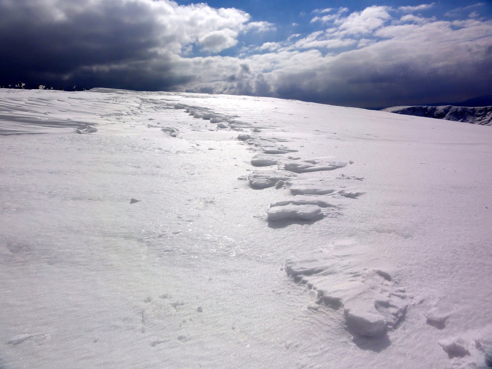 |
| Sistrugi on Kentmere Pike |
That's the lot. Hopefully there will be many more to come as I'm only 98 into the 214 Wainwrights so far. Still a long way to go ...


