Showing posts with label lakeland. Show all posts

Saturday, November 23, 2013

Clough Head, the 'Dodds' and a Wild Camp

Dates: 15th & 16th November 2013
Route: From Wanthwaite to Clough Head, along the Dodd's ridge route & back via Sticks Pass 
Wild Camp : Birkett Fell
Wainwright's: Clough Head, Great Dodd, Watson's Dodd, Stybarrow Dodd, Hart Side
Distance:15.6 miles (25.1 km)
Height Gained: 4300 feet (1310 meters)


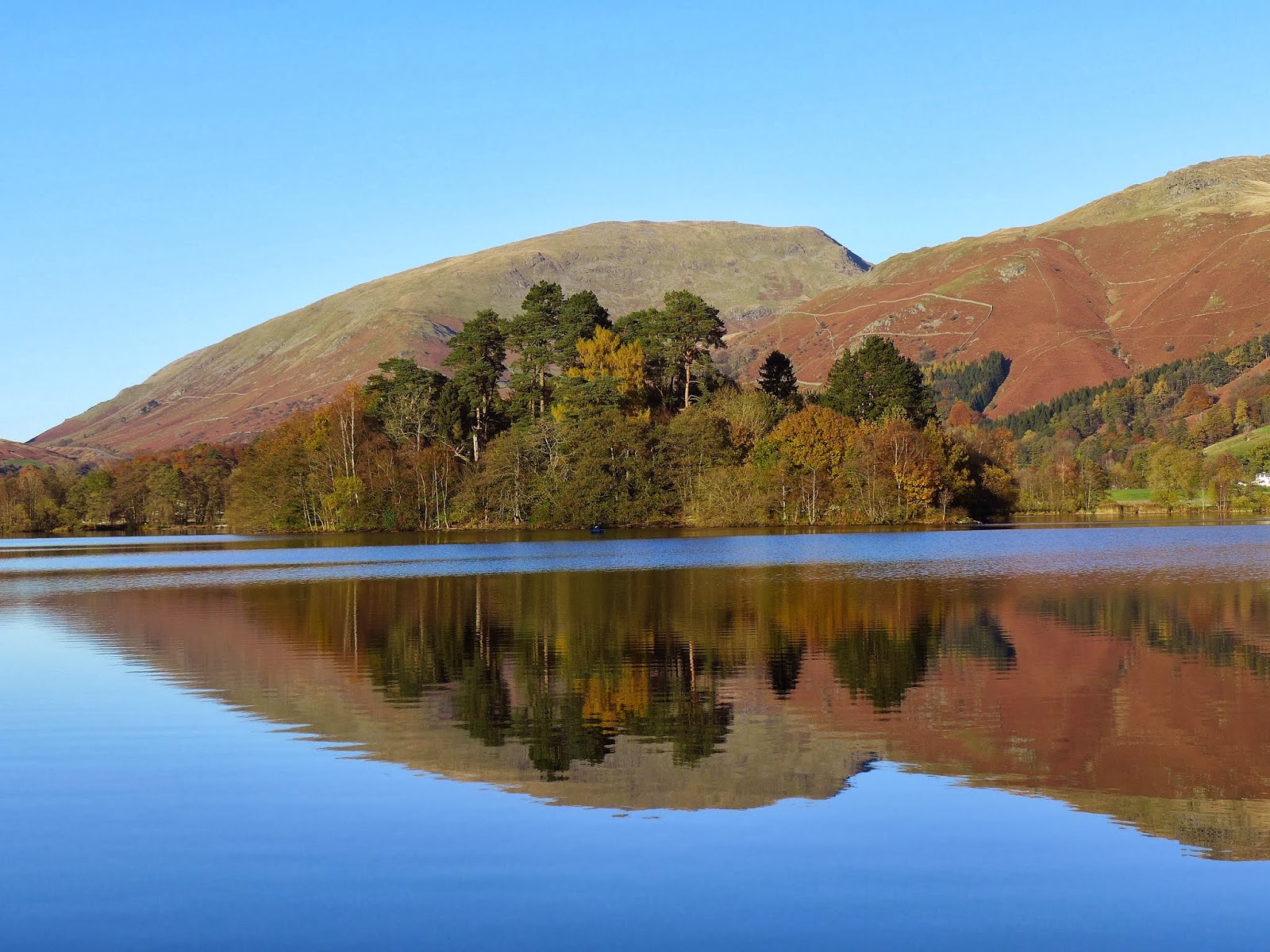
The Route anticlockwise from Wanthwaite

 So I had a Friday booked off work and intended a 2 day jaunt to tackle the northern branch of Wainwright's Eastern fells. As is usual I watched the weather forecast intently over the preceding days and as is also usual I went anyway despite it looking fairly grim with lots of low cloud expected. I am always very envious of folk who can pick and choose the best days to head off to the fells but for me I have to book a week day off and then pray to the weather gods.

 I parked at Wanthwaite and headed off along the old coach road. After a short while a style appears over the dry stone wall on the right and a slightly obscure path meanders steeply up through the old quarry to emerge on the western flanks of Threlkeld Knotts.


The Old Coach Road

The path climbs up through the old quarry

Views back over Wanthwaite towards High Rigg and Low Rigg

 The summit of Threlkeld Knotts is well worth the short diversion from the main objective of Clough Head. There are fine views over to Blencathra and along the Keswick-Penrith valley. This is also a good vantage point to survey Clough Head which appears steep and impenetrable from this side but closer inspection reveals an indistinct path tracking diagonally upwards from left to right before emerging onto Bennesty Knott and the summit ridge. 

One of the large Cairns at Threlkeld Kotts looking West

Views over Threlkeld towards a shrouded Blencathra ...

.. and looking towards the steep north side of Clough Head, the diagonal ascent path is just visible on the right

Views from that diagonal path at Bennesty Knott

 From the top of Bennesty Knott its a short walk along the ridge to the summit of Clough Head. By the time I got there the cloud had descended and visibility was poor. Unfortunately it stayed that way for the rest of the day. 

Clough Head summit

 From Clough Head a good path leads south to Calfhow Pike before plodding steadily upwards to Great Dodd. I would imagine the panorama from here is excellent but I had use my imagination today.


Calfhow Pike

looking back northwards from Calfhow Pike summit

Great Dodd summit and a Raven

Watson's Dodd summit - the clag continues

 The path then continues to snake its way southwards taking in Watson's Dodd and Stybarrow Dodd. I then descended eastwards towards Hart Side and then Birkett Fell before looking for a suitable spot to make camp. By this time the wind had got up and I was thankful to find a dry stone wall on the east side of Birkett Fell which looked like a great wind break. It was only after following the wall downhill looking for a suitably flat area that I got back below the cloud level again.


 Initially the tent was sheltered from the wind but in the early hours it must have changed direction and increased in strength. The noise levels got up and despite ear plugs I got very little sleep afterwards. Next time I really must remember the Whiskey! 

 The twitter chatter that evening suggested that there might be the chance of a cloud inversion the following morning and so it was with some excitement that I unzipped the tent door at 6am to see what awaited. Alas, no inversion but I could see the silhouette of surrounding fells and as the sky lightened I could see that the cloud base was well above the summits. Even Helvellyn was visible. The wind was still gusting strongly though despite being on the lee side of Birkett Fell. A change of plan was in order. I had initially intended to walk along to Sheffield Pike and then return via Dowthwaitehead and the old coach road but feeling somewhat robbed of summit views yesterday I decided to retrace my steps to Great Dodd and then take a longer route back via Matterdale Common.

A reddening sky the next morning


Sunrise

views from the wall near my camp site towards Ullswater

Birkett Fell summit

Birkett Fell looking towards Ullswater

 By the time I walked back up to Birkett Fell summit it became evident that the wind was going to be a torment. I battled against a fierce headwind back up to Hart Side and then along to White Stones.


Hart Side summit at sunrise

Hart Side summit looking towards White Stones and Strybarrow Dodd


White Stones summit looking over Sheffield Pike towards Place Fell and beyond

White Stones summit looking towards Raise and Catstye Cam

White Stones summit looking towards Stybarrow Dodd and Great Dodd

 By the time I got up to Stybarrow Dodd I was struggling to keep balance due to the constant buffeting. I therefore beat a hasty retreat down to Sticks Pass and descended to Legburthwaite before walking the last few miles along the road to the car at Wanthwaite.

Stybarrow Dodd summit looking south towards Raise

Stybarrow Dodd summit plateau looking north towards Watson's Dodd & Great Dodd

Descending Sticks Pass

Looking back up Stanah Gill to Stybarrow and Watson's Dodds

Looking down over Great How and Thirlmere

Views towards Skiddaw from Sticks Pass
Wanthwaite Crags on Clough Head

 So a challenging 2 days in the fells. Following the all day clag on Friday at least I managed some good views from Stybarrow Dodd and a great sunrise on Saturday. Not many eastern fells left now and I reckon I can polish them off over 2 further day hikes which I will hopefully do before the end of the year.


Kit List

Shelter : Tarptent Scarp 1 (1.3kgs)
Mat : Exped SynMat7 UL LW (595g)   
Sleeping Bag : Rab Alpine 400 (970g)    
Stove : High Gear Blaze titanium stove (48g)  + Primus 100g Gas Cart   
Pans : Evernew Solo-set (250g)
Rucksack : Osprey Talon 44 (1.18kg) 

Trekking Poles : Black Diamond trail compact (488g pair)
Fluid : Deuter Streamer 2lt Bladder (185g) and 600ml Sigg bottle (100g empty) + Sawyer Squeeze filter (84g), 100 mls milk, coffee  
Food : Wayfayrer Tai Green Curry, Buttered Bread, Supernoodles,various sugary snacks.
Bits & Bobs : headtorch and spare batteries, Iphone + Anker 5800mHh battery,  victorinox knife, map & compass, basic first aid kit and Petzl e-lite, spork, various fold dry bags, flint & steel, plastic trowel.  
 

Camera : Panasonic DMC-LX7 & lowepro case.  
Clothes : Ron Hill wicking T-Shirt, Rab 100 wt fleece (250g), Montane Lightspeed windproof jacket (160g), Montane Prism 2 insulated jacket (423g), ME beany, TNF 'E Tip' gloves, sunglasses, Buff, Bridgedale socks & spare Sealskinz socks.  Hard Shell = Mountain Equipment Firefox jacket (320g) and trousers (259g) not used.
Trail Shoes : Meindl Respond GTX (820g pair) .


 Stand out pieces of kit (apart from the brilliant Scarp tent) were the Montane Prism 2 jacket which kept me warm and comfortable in the cold winds and also the TNF 'E Tip' gloves which won't win any awards for durability but kept my hands warm without having to continually take them off to use the touch screen phone. In the future, all gloves will be like this !

Sunday, November 10, 2013

An Autumn Stroll Around Grasmere

Date: 10th November 2013
Route : An anticlockwise circuit of Grasmere from the car park under Nab Scar

This was an autumnal stroll with the family around Grasmere. No chat but some great photos. Grasmere was like glass and the light was superb in the late afternoon as the the sun set over Loughrigg.


Helm Crag


Autumn Reflections


Silver How from the Road


An Acer in full autumn splendour


A kaleidoscope of Autumn colours


looking over to Nab Scar


Helm Crag Reflection


Helm Crag and Seat Sandal over a glass-like Grasmere


Nab Scar over Grasmere


Grasmere island and a fishing boat
Grasmere Island and Seat Sandal reflection


The Waterside Hotel over Grasmere


A friendly swan ....


... stretching its wings - got lucky to catch this pic

Friday, November 1, 2013

Mopping up the Far Eastern Fells (nearly)

Date: 1st November 2013
Route : From Troutbeck along the old Roman Road to Thornthwaite Crag, then along to Gray Crags, back to Stony Cove Pike, along to Hartsopp Dodd and back via the Troutbeck valley.
Wainwrights: Troutbeck Tongue, Thornthwaite Crag, Gray Crag, Caudale Moor (Stony Cove Pike), Hartsop Dodd
Distance: 14.8 miles (23.8km)
Height Gained: 4349 feet (1325m)

 
The Route


 The intention of this hike was to try and mop up a few of the remaining 5 far eastern fells I have yet to complete; Troutbeck Tongue, Caudale Moor (Stony Cove Pike), Hartsop Dodd, Gray Crag and Steel Knotts. I had a free day but there was clearly no possible route to climb them all without a lot of unsatisfactory driving between them. Steel Knotts was going to have be left for another day, but what route to climb the other 4? I didn't want to park high up on the Kirkstone pass to gain access to these fells as that also seems somewhat unsatisfactory to me. The best route therefore would be to park at Troutbeck, walk along the valley to Troutbeck Tongue and then climb the old Roman Road up to Thornthwaite Crag from where I could access the other fells. This would mean I would need to walk back and forth along the same ridges to Gray Crag and Hartsop Dodd but that was a small price to pay to climb the full heights of these fells properly. 


The path to Troutbeck Park - Troutbeck Tongue dead ahead


Left = Trout Beck & Threshthwaite.  Right = the Roman Road to High Street.   Ahead = Troutbeck Tongue

 I set off at first light along the access road to Troutbeck Park. At the signpost above I headed right along the old Roman Road path. There is no marked path to the summit of Troutbeck Tongue on the OS map but after a short while a bracken strewn track appears on the left which climbs steeply up to the summit.


Sun rising slowly over Bonscale Pike


Troutbeck Tongue summit looking south towards Windermere


Sun rising over the shoulder of Yoke

 
Summit Panorama Video


The northern panorama from Troutbeck Tongue
 
 From the summit a good path then continues northwards along level ground until the main roman road path is rejoined.


At the 'back' of the Tongue looking north to Threshthwaite Mouth

 The grassy path then climbs steeply up the flanks of Froswick and Thornthwaite Crag before emerging onto the ridge. Its then a short walk to the impressive Thornthwaite Beacon which marks its summit.

 
A great view of the 'Tongue' from the roman road


Kentmere Reservoir appears once on the Ill Bell ridge


The impressive 14 foot high Thornthwaite Beacon

 
 Summit Panorama Video

 A good path then continues northwards towards Gray Crag along a ridge giving fine views east over the Hayeswater valley to High Street and west over the Pasture Beck valley towards Hartsopp Dodd and the Fairfield / Helvellyn range beyond.


The ridge path to Gray Crag


Rest Dodd and The Knott over Hayeswater


Gray Crag summit looking west over Hartsop Dodd to the Helvellyn range


Gray Crag summit panorama west


Gray Crag summit panorama east

 
 Summit Panorama Video

 Having found Gray Crag neither grey nor craggy I retraced my steps back along the ridge before veering off right towards Stony Cove Pike.


Stony Cove Pike and the Threshthwaite Mouth col


Looking back southwards towards Troutbeck Tongue from Threshthwaite Mouth


Looking north towards Ullswater from Threshthwaite Mouth


The steep path up Stony Cove Pike from Threshthwaite Mouth

 A bit of scrambling is required to negotiate the steep path up onto Stony Cove Pike summit. Only then did I see the first other people since leaving the car 4 hours ago.


Thornthwaite Crag (the Beacon just visible) from Stony Cove Pike


Stony Cove Pike summit view towards the Ill Bell ridge


Stony Cove Pike summit panorama east


Stony Cove Pike western summit cairn panorama west


Looking over Red Screes from Stony Cove Pike western summit cairn

 
 Summit Panorama Video

 A 30 min walk along the ridge to Hartsop Dodd completes the fell for the day. This little fell occupies a grand position with great views towards Ullswater and over the valley to the high peaks of Fairfield, Helvellyn et al. 


Hartsopp Dodd summit view north towards Ullswater


Hartsop Dodd summit view east to the Helvellyn range


Looking back to Stony Cove Pike from Hartsop Dodd  


 Summit Panorama Video

 I then wandered back along the ridge to Stony Cove Pike before heading along the Doup Crag ridge and then back down to the Troutbeck valley.


Place Fell from the Hartsop Dodd ridge


Yoke, Ill Bell and Froswick from near Doup Crag


Zoomed in from the Troutbeck valley a Red Deer stag stands proudly up on Hart Crag ...


... and is then joined by a Hind


The pack horse bridge crossing Trout Beck


Looking back along the route trod from near the start of the walk

So that's 110 Wainwrights completed and 104 yet to go. I'm finally past the half way mark. Its all downhill from now on - so to speak.


Conditions and Kit


There was bitingly cold wind today which was strong enough to make standing still difficult on the summits. I wore a Rab Vapour rise jacket over a short sleeved base layer which is normally enough to keep me warm in most conditions including winter but today, the windchill had me reaching for an insulating layer over the top. I wore a Montane Prism jacket which kept me warm all day. My legs rarely feel cold and I usually hike in shorts over 3 seasons but today I wore Sprayway Challenger softshell trousers which did the job well. It didn't rain so the hard shell stayed stowed. Woolly beanie and gloves were most definitely required. Having been fed up of taking off gloves to use the screen on my phone, I recently bought a pair of The North Face apex E-tip gloves which use a conductive material in the tips of the thumb and index fingers so they work with the capacitative screens used on most smart phones. They worked a treat, providing enough dexterity for texting etc while having a fairly grippy palm for grasping stuff and most importantly, keeping my hands warm. I was very impressed. Of course they aren't going to win any prizes for durability and I'm sure that excessive contact with abrasive rocks will cause them problems. They aren't waterproof either but I don't tend to use gloves with membranes as my hands sweat too much in them. I prefer to use dexterous fabric gloves and then Extremities Tuff bags paclite shell mitts over the top in wet weather. So for these E-tip gloves, on the basis of one very cold and windy day, they worked well and I didn't need to take them off for anything all day.