
Start/Finish: Skelwith Bridge
Wainwrights: Black Fell & Holme Fell
Distance: 8.1 Miles
Height Gained: 2013 feet
Time Taken: 5 hours
 |
| View of the day: Windermere from Holme Fell |
 |
| The route: Clockwise from Skelwith Bridge (top right) |
The forecast was poor. Low cloud and some rain. I figured it might be a good day to tick off some of the smaller Wainwrights that had a chance of staying below the cloud base. This was a blessing in disguise as I was feeling particularly unfit after a 3 month absence from the fells. From the 'to-do' list, Black Fell and Holme Fell looked good for a nice low level circuit.
 |
| The little road from Skelwith Bridge |
 |
| The scent of spring |
 |
| The first of many lovely little cottages seen today |
The walk started well enough. A nice woodland path lined with bluebells and freshly unfurling bracken. There wasn't an obvious path up onto Black Fell so I just headed upwards along vague forestry tracks until one materialised near the summit. It's a nice little fell, well placed to peruse the surrounding area and offering particularly good views of Windermere.
 |
| Views over to Loughrigg |
 |
| Black Fell |
 |
| Windermere from the summit |
 |
| Summit trig - named Black 'Crag', despite there being minimal 'craggyness' |
From here my intention was to make a beeline straight towards Holme Fell but that route looked a little dull. I consulted the map over a Coffee and a Tunnocks wafer and decided that I should probably extend the walk around Tarn Hows which would be far more picturesque.
 |
| Looking over to Holme Fell and Wetherlam beyond |
 |
| A path and some trees |
At this point the rain set in. The forecast predicted a few fleeting light showers and so I put my trust in the met office and stubbornly left the waterproofs and rucksack cover in the pack. The rain became heavier. I passed a few goretex clad people who glanced at me with knowing looks of superiority. The rain became torrential. Eventually I accepted defeat, took shelter under a tree and begrudgingly donned the shell jacket and fitted the rucksack cover. I set off with renewed purpose. The rain stopped. I stubbornly left the waterproofs on as I convinced myself that the clouds still looked threatening. The sun came out. I passed a few people in T-shirts who glanced at me with knowing looks of superiority. I started sweating. Eventually I accepted defeat and took off the waterproof garb. I continued on with a niggling feeling that there was probably a lesson to be learned here about using layers effectively but convinced that my many years of hill walking experience meant I was already an expert in such matters.
 |
| Tarn Hows looks pretty in any weather - even though it is entirely man made |
 |
| Tarn Hows in October 2012 - from a previous walk in better weather |
I followed the waterfalls path down from Tarn Hows to Yew Tree Farm and then up onto Holme Fell.
 |

 |
| Yew Tree Farm |
 |
| Holme Fell, looking quite ominous for its size |
 |
| Wild Garlic - You can almost smell it! |
 |
| A giant killer slug |
 |
| A fell cow |
 |
| A fell cow savaging the local flora |
 |
| Hunting in packs |
 |
| Views over to Langdale from Ivy Crag |
 |
| The real summit of Holme Fell is over there, with Wetherlam beyond |
|
| Lunch spot view of Windermere from Holme Fell summit |
 |
| Wetherlam |
 |
| Funny looking 'Reservoir' |

 |
 |
 |
| The old slate quarry |
 |
| Venue for next years 'Red Bull cliff diving' event |
 |
| Yeh I could live there ... |
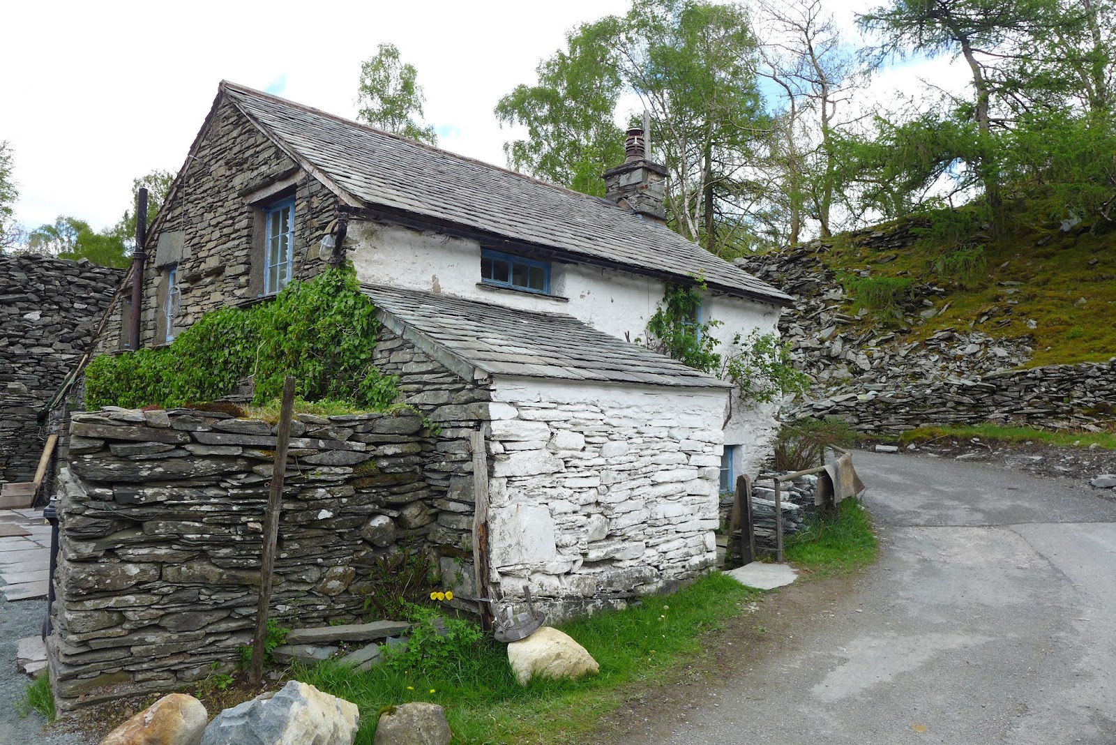 |
| ... and there |
 |
| Lingmoor Fell |
 |
| A cryptic message asking dog owners to introduce their pets to leads |
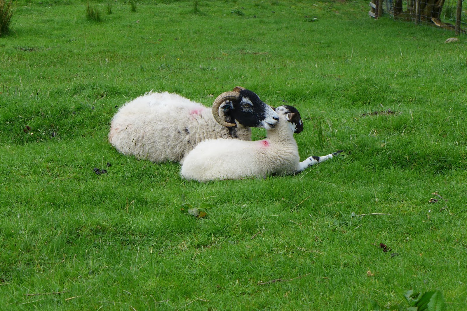 |
| Ahhh ..... or should that be Bahhh |
 |
| I could live there too ... |
 |
| Yep I could definitely adjust to such squalor |
 |
| I could even tolerate the ram shackled garden |


